Event 38 and Inertial Labs Partner to Bring Large Scale Lidar Mapping to the Drone Industry
New Partnership
Event 38 and Inertial Labs Partner to Bring Large Scale LiDAR Mapping to the Drone Industry

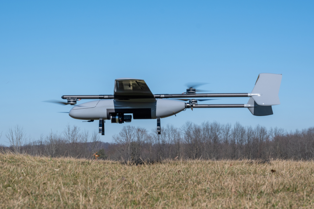
Event 38 Unmanned Systems, a leading manufacturer of unmanned aerial vehicles, has announced that its heavy VTOL E455 drone can now be paired with multiple LiDAR systems.
LiDAR Options for the E455
The RESEPI Hesai XT-32 LiDAR developed by Inertial Labs can now be integrated onto the E455 drone for all Event 38 customers. The E455 will also carry NDAA-compliant LiDAR models such as the RESEPI Ouster OS1-64.
What Is RESEPI?
RESEPI (Remote Sensing Payload Instrument) is a sensor-fusion platform designed for accuracy-focused remote sensing applications. It combines:
Built to Carry More, Fly Longer
One of the many notable features of the E455 is its versatility and unique ability to carry heavier payloads. Flight time with Event 38’s LiDAR-compatible systems extends beyond 2 hours and allows for advanced operations, giving operators greater range and efficiency during each and every flight.
The RESEPI featuring Hesai’s XT-32, along with its NDAA-compliant counterparts, was strategically designed for multiple application bases and can support projects of all different varieties.
By combining our advanced RESEPI Payload LiDAR with Event 38’s sophisticated E455 drone, we are setting a new standard for aerial surveying and mapping technology. This collaboration represents a leap forward in our mission to provide comprehensive, turnkey solutions that empower industries to achieve more.
Jamie Marraccini / CEO, Inertial Labs
“The high pulse rate and accuracy of the RESEPI LiDAR systems paired with the E455 is a powerful combination giving operators the ability to collect thousands of acres of survey grade data in a single workday. It’s a new level of capability not previously available to our customers.”
Jeff Taylor / CEO, Event 38 Unmanned Systems
For more information, contact us or email sales@event38.com.