
Event 38’s E455 Drone Supports Los Alamos Researchers in Locating Oil and Gas Wells
Field Report
Event 38’s E455 Drone Supports Los Alamos Researchers in Locating Oil and Gas Wells
A Smarter Way to Find Hidden Oil and Gas Wells
Across much of the United States, remnants of early oil and gas development remain scattered beneath the landscape.
Many wells were drilled decades ago, before modern mapping and reporting standards existed. Some were poorly documented, others never recorded at all. Over time, they were abandoned, overgrown, or buried under farmland: out of sight, but not without risk.
These forgotten wells can still leak methane or contaminate groundwater, creating environmental and safety concerns that are difficult to address when their locations are unknown.
Finding them isn’t easy. Historical records are often incomplete, terrain can be remote or difficult to access, and traditional ground surveys are time-consuming, expensive, and sometimes unsafe. To overcome these challenges, researchers at Los Alamos National Laboratory (LANL) are combining artificial intelligence with aerial data collection, using drones to turn predictions into verified locations.
Turning AI Predictions into Confirmed Sites
The effort begins with machine learning. LANL researchers analyze historical well records, geological data, and spatial patterns to identify areas where undocumented wells are most likely to exist. While these models help narrow the search, predictions alone aren’t enough. Confirmation requires real-world data collected directly from the landscape.
That’s where aerial surveying plays a critical role.
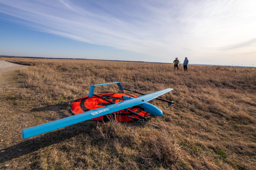
Using Event 38’s E455 VTOL fixed-wing drone, researchers can fly precise, low-altitude survey patterns over large areas. The aircraft is equipped with high-sensitivity magnetometers. These sensors are designed to detect subtle magnetic disturbances in the ground. These anomalies often indicate buried steel well casings or other subsurface infrastructure.
Collecting this data from the air allows researchers to confirm potential well locations without disturbing the terrain or relying on extensive ground access.
Why Airborne Surveys Make the Difference
Wide-area magnetometer surveys have traditionally been difficult to scale. Ground-based surveys require significant time and manpower, and many sites are simply inaccessible. Manned aircraft can cover ground more quickly, but they’re expensive and often can’t fly low enough to capture the level of detail required for this kind of work.
The ability to perform wide-area magnetometer surveys from the air hasn’t been practical at scale until recently. With the E455, researchers can identify lost wells, unexploded ordnance, and other buried anomalies in areas that would otherwise be impossible or unsafe to access.
Jeff Taylor / Founder & CEO, Event 38 Unmanned Systems
The E455’s hybrid design, combining vertical takeoff and landing with efficient fixed-wing flight, allows it to operate from remote launch sites while still covering large areas efficiently. Its modular payload system lets researchers customize sensor configurations for each mission, and its long-range communications and extended endurance support the collection of high-quality data across challenging terrain.
Reach out to discuss how the E455’s capabilities could support your operation.


