• Shopping Cart Shopping Cart
    0Shopping Cart
Event 38 Unmanned Systems
  • Event 38
    • About Us
    • Newsletter
    • Capabilities
    • Careers
  • Products
    • The E400 Mapping Drone
    • E400 ISR Security Drone
    • The E455 Heavy Lift FW-VTOL
    • Mobile Command Center
    • GNSS Survey Equipment
  • News
  • Contact Us
  • Click to open the search input field Click to open the search input field Search
  • Menu Menu

Tag Archive for: Event 38

Event 38 Integrates CENTUM’s Lifeseeker Mini S10 on the E455 Heavy-Lift VTOL Platform

January 19, 2026/in News/by awilber

New Integration

Event 38 Integrates CENTUM’s Lifeseeker Mini S10 on the E455 Heavy-Lift VTOL Platform

January 19, 2026Public SafetyE455
CENTUM Lifeseeker Mini S10 integrated on the Event 38 E455 heavy-lift VTOL drone

Event 38 Unmanned Systems and CENTUM have completed the integration of the Lifeseeker Mini S10 system on Event 38’s E455 fixed-wing VTOL platform, delivering a powerful new capability for public safety, search and rescue, and mission-critical operations.

CENTUM, a product-driven company specializing in airborne technology based on mobile phone systems, developed Lifeseeker Mini as an airborne solution designed to help locate missing persons by geolocating cell phones, even in areas without network coverage. With its optimized size, weight, and power (SWaP), Lifeseeker Mini is engineered for seamless integration into drone platforms like the E455, enabling fast deployment and greater operational effectiveness in complex environments.

No Signal
Locates phones without network coverage
SWaP
Optimized for drone integration
Since 2011
Event 38 building fixed-wing VTOL

Expanding Mission Capability for Public Safety Agencies

Based in Richfield, Ohio, Event 38 Unmanned Systems designs and manufactures high-performance fixed-wing VTOL drones for commercial, government, and public safety customers worldwide. Since 2011, Event 38 has delivered advanced unmanned aircraft systems that capture precise, geo-tagged data to support a wide range of missions across multiple industries.

Event 38’s flagship platform, the E455, is a heavy-lift, long-endurance fixed-wing VTOL drone engineered for:

01
ISR
Intelligence, surveillance, and reconnaissance.
02
High-Precision Mapping
Precise, geo-tagged data over large areas.
03
Infrastructure Inspection
Reliable coverage of critical infrastructure.

With extended flight times, secure communications, and support for advanced payload integrations, the E455 is uniquely built to meet the demanding needs of public safety and government operators around the world.

With the Lifeseeker Mini S10 now integrated, the E455 expands its mission versatility, bringing a new layer of capability to teams working to locate missing persons and respond faster in time-sensitive situations.

Built for the Realities of the Field

This integration underlines the adaptability and mission-readiness of Lifeseeker Mini. It reinforces our commitment to making life-saving technology available through trusted, proven unmanned systems.

Javier Chamorro  /  President, CENTUM

“The E455 was built to support missions where reliability and capability can make all the difference. By integrating the Lifeseeker system, we’re giving responders the ability to locate missing persons faster and operate more effectively in the field. It’s an example of how we listen to our customers and deliver solutions that truly meet their needs.”

Jeff Taylor  /  CEO & Founder, Event 38 Unmanned Systems

Learn More
Equip Your Team

To learn more about the E455 platform and its mission-ready payload capabilities, contact us or email sales@event38.com.

Explore the E455Contact Us
https://event38.com/wp-content/uploads/2026/01/IMG_4570-scaled.jpg 1920 2560 awilber https://event38.com/small-logo-4.png awilber2026-01-19 10:14:052026-09-28 13:02:20Event 38 Integrates CENTUM’s Lifeseeker Mini S10 on the E455 Heavy-Lift VTOL Platform

Event 38’s E455 Drone Supports Los Alamos Researchers in Locating Oil and Gas Wells

December 18, 2025/in News/by awilber

Field Report

Event 38’s E455 Drone Supports Los Alamos Researchers in Locating Oil and Gas Wells

December 18, 2025ResearchE455
Event 38 E455 VTOL drone supporting Los Alamos National Laboratory well-detection surveys

A Smarter Way to Find Hidden Oil and Gas Wells

Across much of the United States, remnants of early oil and gas development remain scattered beneath the landscape.

Many wells were drilled decades ago, before modern mapping and reporting standards existed. Some were poorly documented, others never recorded at all. Over time, they were abandoned, overgrown, or buried under farmland: out of sight, but not without risk.

These forgotten wells can still leak methane or contaminate groundwater, creating environmental and safety concerns that are difficult to address when their locations are unknown.

Finding them isn’t easy. Historical records are often incomplete, terrain can be remote or difficult to access, and traditional ground surveys are time-consuming, expensive, and sometimes unsafe. To overcome these challenges, researchers at Los Alamos National Laboratory (LANL) are combining artificial intelligence with aerial data collection, using drones to turn predictions into verified locations.

Turning AI Predictions into Confirmed Sites

01
Predict
Machine learning analyzes historical well records, geological data, and spatial patterns to flag likely locations.
02
Survey
The E455 flies precise, low-altitude patterns carrying high-sensitivity magnetometers.
03
Confirm
Magnetic anomalies point to buried steel well casings, verified without disturbing the terrain.

The effort begins with machine learning. LANL researchers analyze historical well records, geological data, and spatial patterns to identify areas where undocumented wells are most likely to exist. While these models help narrow the search, predictions alone aren’t enough. Confirmation requires real-world data collected directly from the landscape.

That’s where aerial surveying plays a critical role.

Using Event 38’s E455 VTOL fixed-wing drone, researchers can fly precise, low-altitude survey patterns over large areas. The aircraft is equipped with high-sensitivity magnetometers. These sensors are designed to detect subtle magnetic disturbances in the ground. These anomalies often indicate buried steel well casings or other subsurface infrastructure.

Collecting this data from the air allows researchers to confirm potential well locations without disturbing the terrain or relying on extensive ground access.

Why Airborne Surveys Make the Difference

Wide-area magnetometer surveys have traditionally been difficult to scale. Ground-based surveys require significant time and manpower, and many sites are simply inaccessible. Manned aircraft can cover ground more quickly, but they’re expensive and often can’t fly low enough to capture the level of detail required for this kind of work.

The ability to perform wide-area magnetometer surveys from the air hasn’t been practical at scale until recently. With the E455, researchers can identify lost wells, unexploded ordnance, and other buried anomalies in areas that would otherwise be impossible or unsafe to access.

Jeff Taylor  /  Founder & CEO, Event 38 Unmanned Systems

The E455’s hybrid design, combining vertical takeoff and landing with efficient fixed-wing flight, allows it to operate from remote launch sites while still covering large areas efficiently. Its modular payload system lets researchers customize sensor configurations for each mission, and its long-range communications and extended endurance support the collection of high-quality data across challenging terrain.

01
Hybrid VTOL
Launches from remote sites, then covers large areas in efficient fixed-wing flight.
02
Modular Payloads
Sensor configurations customized for each mission.
03
Long Range & Endurance
High-quality data collection across challenging terrain.
Have a Survey Challenge?
Map What’s Beneath

Reach out to discuss how the E455’s capabilities could support your operation.

Explore the E455Contact Us
https://event38.com/wp-content/uploads/2025/12/LOSALAMOS.jpg 593 890 awilber https://event38.com/small-logo-4.png awilber2025-12-18 12:02:562026-09-28 12:53:26Event 38’s E455 Drone Supports Los Alamos Researchers in Locating Oil and Gas Wells

Event 38 Featured in World Pipelines Magazine

September 16, 2025/in News/by awilber

In the Press

Event 38 Featured in World Pipelines Magazine

September 16, 2025PressE455
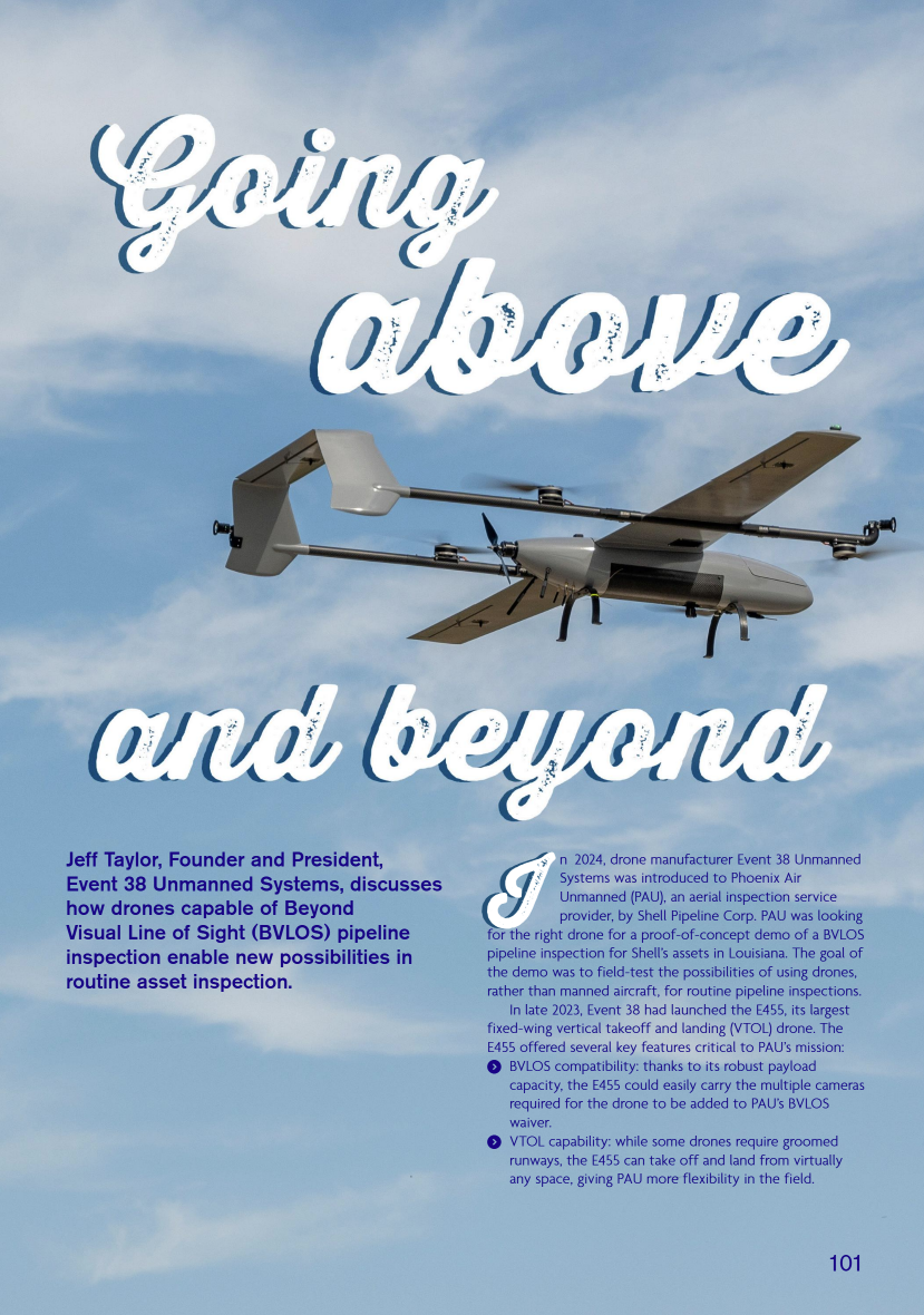
Event 38's E455 drone featured in World Pipelines magazine, August 2025

Event 38 Unmanned Systems is excited to share that our E455 drone was recently featured in World Pipelines magazine.

The article showcases how the E455 is advancing BVLOS capabilities for pipeline inspections.

This recognition in a leading international publication highlights the growing role of drone technology in infrastructure monitoring and positions Event 38 at the forefront of the next generation of utility inspection solutions.

Read the Full Feature
World Pipelines
August 2025Page 101

Read the Article

Inspecting Pipelines?
Go Beyond Visual Line of Sight

Reach out to discuss how the E455’s capabilities could support your operation.

Explore the E455Contact Us
https://event38.com/wp-content/uploads/2025/09/Pipeline-magazine.png 1180 829 awilber https://event38.com/small-logo-4.png awilber2025-09-16 14:14:172026-09-28 13:04:15Event 38 Featured in World Pipelines Magazine

EVENT 38 ANNOUNCES SUCCESSFUL BVLOS PIPELINE INSPECTION DEMO WITH  FIXED-WING VTOL DRONE 

February 12, 2025/in News/by awilber

Press Release

Event 38 Announces Successful BVLOS Pipeline Inspection Demo with Fixed-Wing VTOL Drone

February 12, 2025Pipeline InspectionE455
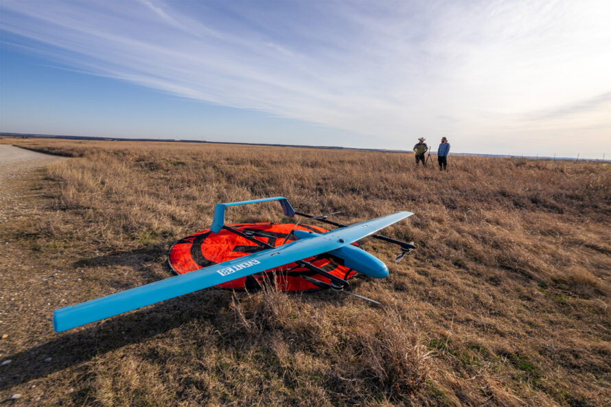
Event 38 team with the E455 fixed-wing VTOL drone during the BVLOS pipeline inspection demo

Richfield, Ohio — Event 38 Unmanned Systems, a leading manufacturer of American-made mapping drones, announces that a successful BVLOS pipeline patrol demo has been completed using the E455, Event 38’s largest fixed-wing vertical takeoff and landing (VTOL) drone.

320 mi
Flown during the demo
7.6 hrs
Just under, in flight time
0
Times signal was lost

The demo was executed by Phoenix Air Unmanned (PAU), a drone service provider that specializes in aerial inspection and surveillance for utilities.

300 Miles of Pipeline in a Day

The demo was a proof-of-concept exercise to determine whether PAU could achieve the goal of patrolling 300 miles of pipeline, owned by Shell Pipeline Corporation, with a drone in just one day.

We woke up to a two-hour delay with fog, so we crossed the 300-mile mark at noon on the second day. But our goal was achieved within a day of flying time, so it was a success.

Will Wheeler  /  Director of Operations, Phoenix Air Unmanned

Trained, Integrated, Flying

3 Days
Pilot Training
Event 38 trained a team of six PAU pilots.
<1 Week
Integration
The E455 was integrated into PAU’s existing command control stations.
Next Week
Demo Complete
The 300-mile demo was completed the following week.

Wheeler credits much of the demo’s success to the user-friendly design of the E455.

“Ease of use and reliability is a big deal for us. We have the foundational knowledge of how to execute BVLOS flights at scale, however we had never flown the E455 before. We received training, the E455 was integrated, and then we were out there doing 300 miles. What will we be capable of once our whole crew has experience with this platform and it’s truly integrated into our workflow? It’s repeatable and scalable.”

Will Wheeler  /  Director of Operations, Phoenix Air Unmanned

Equipped for BVLOS

For the purposes of the demo, the E455 was outfitted with:

01
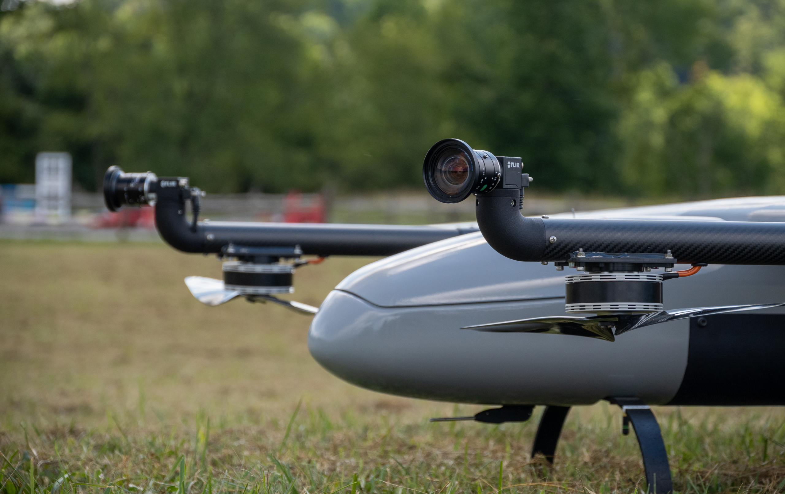
Iris Casia 3-Camera System
Critical for BVLOS missions.
02
Two Redundant Radio Links
A bonded radio solution that never lost signal.
03
ADS-B In
Awareness of surrounding air traffic.
04
Live Gimbaled Camera
A standard live video camera.

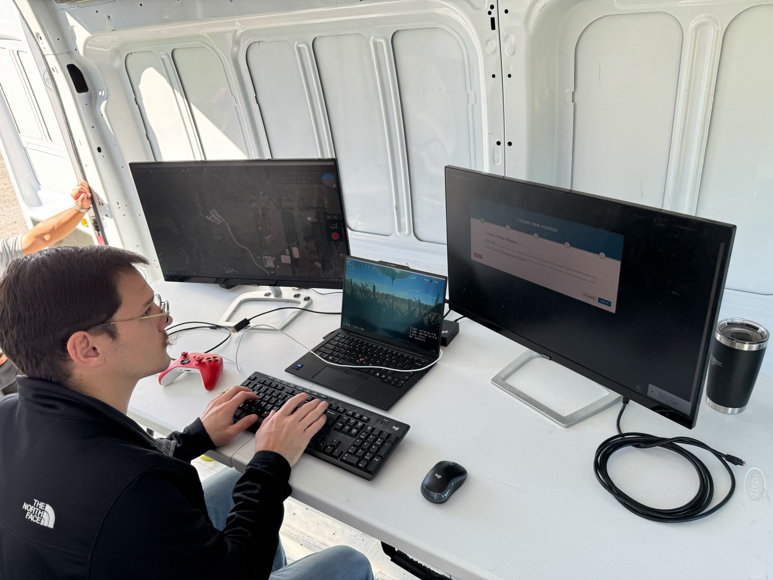
Drone communications were handed off between three ground control vans to increase efficiency, and ground control received a constant live video feed from the E455’s on-board cameras. Thanks to the E455’s bonded radio solution, the drone never lost signal with PAU.

Even with the abundance of equipment required for a BVLOS mission, the E455 flew for up to sixty minutes on a single charge. With a standard payload, the E455 can fly for over two hours on a single charge. In optimal conditions, the E455 can travel at 50 miles per hour.

“This demo was an excellent opportunity for us to learn more about how the E455 operates in real-world scenarios and make some other modifications that will translate to a better user experience going forward.”

Mathew Wright  /  VP of Engineering & Operations, Event 38

About Event 38 Unmanned Systems

Event 38 designs and manufactures fixed-wing VTOL drones in Richfield, Ohio. Since 2011, we’ve sold over 500 drones to people and organizations all around the globe. Our drones capture geo-tagged data for a range of industries and applications. Event 38 drones can be customized for high-resolution aerial photogrammetry, thermal and multispectral imagery, LiDAR, and live video streaming.

Planning BVLOS Operations?
Patrol More Miles

Reach out to discuss how the E455’s capabilities could support your operation.

Explore the E455Contact Us
https://event38.com/wp-content/uploads/2024/11/Mat_Pointing.png 379 500 awilber https://event38.com/small-logo-4.png awilber2025-02-12 14:45:082026-09-28 13:05:47EVENT 38 ANNOUNCES SUCCESSFUL BVLOS PIPELINE INSPECTION DEMO WITH  FIXED-WING VTOL DRONE 

Event 38 Unmanned Systems Teams Up with AviSight in Selecting Elsight’s BVLOS Connectivity Solution

November 25, 2024/in News/by awilber

Press Release

Event 38 Teams Up with AviSight in Selecting Elsight’s BVLOS Connectivity Solution

June 13, 2024Pipeline InspectionE455
Event 38 E455 VTOL drone used with Elsight Halo connectivity for AviSight BVLOS pipeline inspections

Leading manufacturer of unmanned aerial vehicles Event 38 and AviSight, a provider of critical infrastructure inspections, announced the use of Elsight’s Halo, an AI-based UAV connectivity solution, to enable beyond-visual-line-of-sight (BVLOS) inspections with precise data collection in extensive oil and gas pipeline inspections over difficult terrain.

2,000+ mi
Of pipeline inspections
2 hrs
E455 endurance on battery alone
<55 lbs
E455 aircraft weight

Uninterrupted Communications with Elsight Halo

At the heart of this collaboration is Elsight’s Halo, a lightweight, highly reliable communications system. Halo’s AI-based software aggregates multiple IP links to a secure bond, ensuring uninterrupted drone communications even in the most challenging environments:

01
Cellular
Public and private cellular networks.
02
Satellite
Coverage for the most remote locations.
03
RF
Radio links bonded into one secure connection.

Whether it’s disaster response, surveillance, deliveries or lengthy remote inspections, UAV (uncrewed aerial vehicle) flights powered by the Elsight Halo complete the mission with continuous transmission of high-bandwidth video and data to the command-and-control center (C2).

A Rigorous Selection

When facing the operational and economic challenges of data collection from major pipelines, AviSight’s CEO, Suzanne Herring, was quite rigorous in her selection of the optimal VTOL drone and the BVLOS connectivity solution for these missions. She required connectivity with:

01
The Highest Bandwidth
02
The Lowest Latency
03
The Highest Redundancy
04
The Most Reliable Link

“AviSight’s reputation is dependent on our ability to provide accurate, timely and consistently critical infrastructure inspections through the use of unmanned aerial systems in a cost-effective manner. In a technology market that is rapidly developing, it is essential to remain innovative in our systems methodology while also embodying the challenges of an efficient execution of the mission. With C2 linkage being a primary priority for our BVLOS missions, it was essential to find a partner with the capabilities to maintain communications throughout our volatile terrains. Elsight has provided us with the ability to maintain C2 through vast wetlands, mountainous regions, and remote areas. While Event 38’s E455 has given us the ability to fly extensive linear inspections efficiently and more cost effectively.”

Suzanne Herring  /  CEO, AviSight

We sought the right combination to maintain command and control over more than 2,000 miles of pipeline inspections in a variety of terrains. Event 38 and Elsight enabled us to overcome terrain and distance challenges and provide precise data to our customers ensuring their regulatory compliance.

Suzanne Herring  /  CEO, AviSight

The E455: Built for Long-Distance Inspection

Event 38 Unmanned Systems’ latest VTOL, the E455, is a premier fixed-wing, vertical takeoff and landing (VTOL) drone. At just under 55 lbs, the E455 offers a 2-hour flight endurance on battery power alone. The E455 is designed to carry a diverse range of payloads, including mapping sensors, LiDAR, and EO/IR surveillance sensors, meeting the strict demands of various applications such as lengthy pipeline inspections.

“The high bandwidth and low power usage of the Elsight Halo paired with the E455 open endless possibilities of inspections over long distances and rugged terrain that were not possible previously. Our E455 VTOL was able to get closer to the pipelines with the help of Elsight.”

Jeff Taylor  /  CEO, Event 38 Unmanned Systems

“Working with Event 38 and AviSight has been very fulfilling from both technological and business perspectives. Our Halo was designed for mission-critical goals, particularly, in difficult situations. Elsight optimizes the use of drones in many industries with reliable BVLOS connectivity for operational effectiveness. At the same time, we enable industry growth by using only one operator to control a drone fleet from remote locations anywhere. This is how we see our Halo as a market catalyst for drones in pipelines, and inspections in many industries, in which removing the human element delivers better and safer results.”

Yoav Amitai  /  CEO, Elsight

About AviSight

AviSight provides industrial inspections of critical infrastructure and advanced data solutions for regulatory compliance, asset management, and predictive maintenance. We work with Fortune 100 partners in all verticals of critical infrastructure including Power, Gas, Oil, Telecom, and Transportation. Our mission is to create a generational paradigm shift in data collection and actionability that increases safety exponentially while achieving significant cost savings for our clients. We have been working with our partners and customers on legislative activity and regulatory expansion to ensure the ability to create BVLOS programs that will help take inspections into the 21st century.

About Event 38 Unmanned Systems

Established in 2011 and with customers all over the world, Event 38 Unmanned Systems is a leading provider of Unmanned Aircraft Systems (UAS). Our customers use their drones in diverse fields including Security, Surveying, and Environmental Conservation. Our hybrid fixed-wing VTOL aircraft offer an extended endurance capability for covering dozens of miles or hundreds of acres. With a variety of payload options and customizable solutions available, our aircraft collect thermal, multispectral and high-resolution imagery with centimeter-level geotagging accuracy.

About Elsight

Elsight (ASX:ELS) delivers Connection Confidence with proprietary bonding connectivity that incorporates both software and hardware elements to deliver reliable, secure, high bandwidth communications, even in the most challenging areas for stationary, portable, or actively mobile situational requirements. Elsight provides robust, secured connectivity to unmanned aerial and ground systems manufacturers, operators, and integrators globally.

Inspecting Long Distances?
Stay Connected Beyond Line of Sight

Reach out to discuss how the E455’s capabilities could support your operation.

Explore the E455Contact Us
https://event38.com/wp-content/uploads/2024/11/CLR5622-scaled.jpg 1611 2560 awilber https://event38.com/small-logo-4.png awilber2024-11-25 13:22:302026-09-28 13:08:26Event 38 Unmanned Systems Teams Up with AviSight in Selecting Elsight’s BVLOS Connectivity Solution

Preserving the Endangered Spider Monkey in Ecuador through UAV Forest Monitoring

September 15, 2015/in News/by Jeff

Recently, we discovered that the Ecuadorian organization Drone & GIS has been using our E384 fixed-wing drone for quite the unique and amazing application; saving the spider monkeys. The Brown-headed Spider Monkeys are a critically endangered species, and efforts for their preservation and well-being have been ongoing. By flying our E384 over an area of the forest of about 1200 hectares, Drone & GIS  was able to quickly and efficiently discover which areas of the forest are habitable for the continued well-being of the spider monkey. You can view the full article here.

https://event38.com/wp-content/uploads/2015/11/spidermonk.jpg 260 600 Jeff https://event38.com/small-logo-4.png Jeff2015-09-15 16:36:482016-01-31 01:39:15Preserving the Endangered Spider Monkey in Ecuador through UAV Forest Monitoring

Latest news

  • Event 38 + TB2 Aerospace: DROPS Comes to the E455September 25, 2026 - 4:55 pm
  • Event 38’s E455 Supports U.S. Army Training Exercise in AlaskaFebruary 3, 2026 - 11:24 am
  • Event 38 Integrates CENTUM’s Lifeseeker Mini S10 on the E455 Heavy-Lift VTOL PlatformJanuary 19, 2026 - 10:14 am
  • Event 38’s E455 Drone Supports Los Alamos Researchers in Locating Oil and Gas WellsDecember 18, 2025 - 12:02 pm
  • Event 38 Featured in World Pipelines MagazineSeptember 16, 2025 - 2:14 pm

Categories

  • Blog
  • News

Site Index

  • Homepage
  • About Us
  • Newsletter
  • Contact Us

News

  • Event 38 + TB2 Aerospace: DROPS Comes to the E455September 25, 2026 - 4:55 pm
  • Event 38’s E455 Supports U.S. Army Training Exercise in AlaskaFebruary 3, 2026 - 11:24 am
  • Event 38 Integrates CENTUM’s Lifeseeker Mini S10 on the E455 Heavy-Lift VTOL PlatformJanuary 19, 2026 - 10:14 am
  • Event 38’s E455 Drone Supports Los Alamos Researchers in Locating Oil and Gas WellsDecember 18, 2025 - 12:02 pm

Connect With Us

© Copyright - Event 38 Unmanned Systems 2026
Scroll to top Scroll to top Scroll to top