FLIR Vue Pro Radiometric Sample Data Now Available
Thermal imagery, with its lower resolution and contrast, can be particularly challenging to collect at high quality and even more challenging to stitch into an orthomosaic. With a radiometric sensor, it usually makes sense to perform the actual image analysis individually for each image. For visualization purposes though, creating an orthomosaic does help provide a better big picture view. With the FLIR Vue Pro line of cameras, images are automatically geotagged in flight when purchased or otherwise integrated with an Event 38 aircraft. The operator must then collect data at an appropriate altitude and time of day depending on the application, and collect imagery with enough overlap to be stitched. Here we have a scene with mixed vegetation, pavement, buildings and cars, making stitching relatively easy. Still, we planned for 70% overlap and sidelap to be safe. Higher overlaps may be needed in areas with less distinct features. We also recommend planning to leave at least 2.5 seconds between image captures and to use a class 10 SD card. FLIR cameras can sometimes get behind while trying to save imagery to memory, and then subsequently start missing images. This can be particularly tricky with FLIR cameras because they can usually handle the higher trigger rate for dozens to hundreds of images before falling behind and then missing every other shot for the rest of the mission. Remember to keep winds in mind if you must plan to fly any down-wind segments. If possible, fly crosswind and advance flight lines into the wind so the apparent groundspeed is always less than standard cruise speed.
If you’d like to download the full set of images, you can get access here. This is radiometric data, so be sure to also download a trial of FLIR Tools to get started analyzing in depth. See the annotations below for some interesting features to inspect.
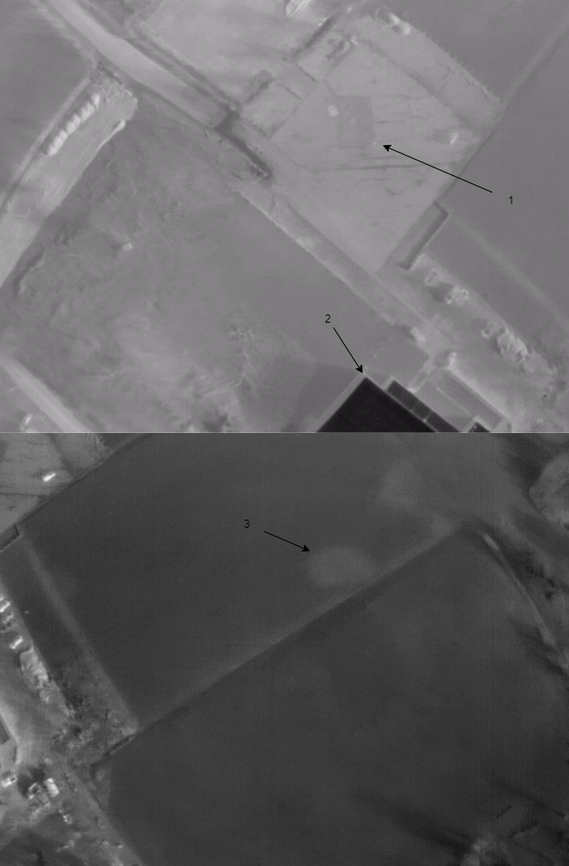
1. Human standing at corner of pavement as seen from FLIR Vue Pro R 640, 9mm from 140m AGL
2. Bare metal roof reflects low temperature of sky
3. Section of grass field damaged by persistent standing water