Drones for
Mining
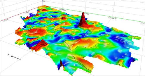
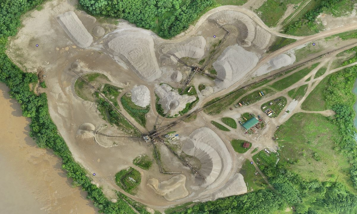
From open-pit surveys to stockpile volumetrics, fixed-wing drones deliver centimeter-accurate data across large mining and quarry sites — faster and safer than any ground-based method.
In an open mine or quarry, a drone survey uses a downward-facing camera to capture images from multiple angles alongside accurate-to-the-centimeter GPS tags.
After flight, photos are processed in photogrammetry software to recreate geo-referenced 3D maps, contour lines, digital terrain models, or digital surface models for review in geospatial software.
Why a Drone?A drone flies at the ideal speed and altitude for extremely high-resolution imagery. Airplanes and satellites fly too fast and too high to capture the same level of detail. Drones capture imagery and GPS data simultaneously — giving you more information to create a more accurate rendering of the area.
Drones can access areas that are dangerous or impossible for ground crews — steep faces, active excavation zones, and large stockpile areas. A UAV can capture comprehensive GPS measurements and other data faster than any manual collection method, reducing man-hours by up to 60%.
Advanced mining software can generate industry-specific data including crests and toes, road boundaries, widths, slope measurements, length, and elevation change — all derived from a single drone flight.
If you're in the planning stages, a drone can help you gather crucial data and conduct mineral exploration in remote areas. Fixed-wing drones can fly at low altitudes and collect extremely high-resolution data on a large area.
Event 38 drones can carry magnetometers and other sensors to help detect any noteworthy minerals underground without having to send in a full team.
Laser scanners must be driven around a worksite and set up over and over to capture data. Conditions must be suitable; high dust levels lead to false data points and lack of detail on the surface, as well as an unacceptable occupational health and safety risk to operators. It is desirable, but not always possible to have a static stockpile, and it is important to ensure the scanner is steady so scan data is consistent. It is also important to make sure the stockpile can be seen from your access points.
This usually requires someone physically climbing quarry stockpiles with the GPS receiver in a backpack. The risk of falling, sliding, or otherwise getting hurt is high, exposing an unacceptable occupational health and safety risk to operators.
A drone is more efficient and much safer than either of these options. UAVs can capture comprehensive GPS measurements and other data faster than manual collection. Read our case study to learn how using a drone at a quarry can reduce man-hours by 60%.
Learn More →