Mapping with PPK, An Assessment of Accuracy
Summary:
The PPK GPS system as integrated into the E384/6 is capable of delivering high scale accuracy when used alone and high absolute accuracy when a known good point is available near the flying site. In this case study, we produced an orthomosaic in the Drone Data Management System™ with 2.45cm horizontal and 5.08cm vertical RMSE, as compared with a survey-grade GPS on the ground.
Data Collection, Equipment and Processing:
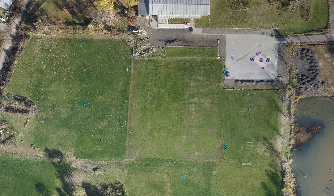
For this study, a high resolution orthomosaic was created and multiple ground control points (GCPs) were collected to check the results. The orthomosaic was built using only the geotags from the onboard GPS. The orthomosaic was built using an E384 outfitted with an Emlid Reach GPS Receiver and a Sony QX-1 Camera. The QX-1 was modified by Event 38 to provide the time that each image was taken down to one millisecond. Having this accurate timestamp is what allows the geotags, and subsequently the orthomosaic to be reconstructed with a high degree of accuracy. After the flight, we processed the RINEX file using an Event 38 utility and RTKLib postprocessing software. These produced a geotag file with coordinates for each image. Then the images and geotag file were uploaded to the Drone Data Management System™ to build the orthomosaic and DEM. The GCPs were measured using a Trimble R6 Model 4, with corrections provided by the Ohio Department of Transportation (ODOT) VRS network. On the day of the flight, the Trimble R6-4 was not present. Instead, the Emlid Reach base station was positioned on a marker that had been previously recorded. Once all the data was compiled, the orthomosaic was visually inspected and each feature representing a GCP was marked manually. Finally, we measured the distance between each marked GCP and the actual GCP location as measured on the ground.
Results:
Table 1 contains the full list of errors for each GCP, both horizontal and vertical. What we found is some variance in individual measurements, with up to 4.29cm horizontal and 6.7cm vertical error. Overall the RMSE was 2.45cm horizontal and 5.08cm vertical.
